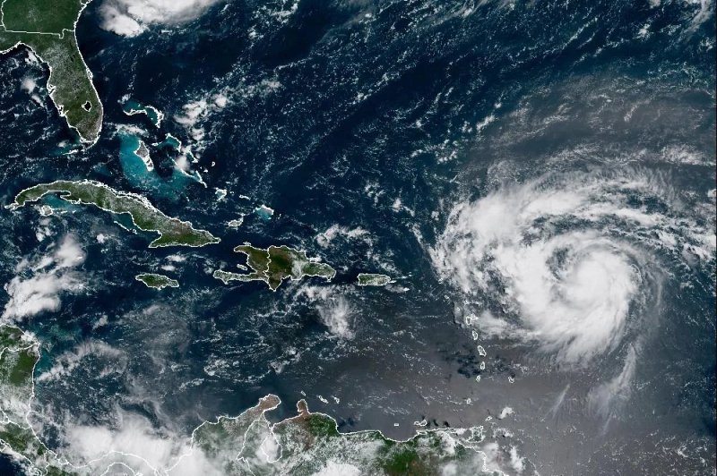
Hurricane Erin, downgraded to a Category 3 storm on Sunday, is battering Caribbean islands with heavy rain, raising concerns over flash floods and landslides as it grows in size and strength.
The storm, the first hurricane of this year’s intense Atlantic season, briefly reached a catastrophic Category 5 before wind speeds weakened, though forecasters warn it could intensify again in the coming days.
Tropical storm warnings remain in effect for the southeast Bahamas and Turks and Caicos Islands, while the hurricane is located about 275 miles north of San Juan, Puerto Rico, moving at dangerous sustained winds.
The National Hurricane Center (NHC) said Erin’s core is expected to pass east and northeast of the Turks and Caicos Islands and southeastern Bahamas, while residents in Bermuda, the central Bahamas, and North Carolina should remain alert.
Experts caution that Erin could dump as much as eight inches of rain in isolated areas, triggering urban flooding, landslides, and mudslides, while swells threaten coastal erosion along the US East Coast.
Meteorologists attribute the storm’s rapid intensification to rising sea temperatures linked to human-driven climate change, noting that the Atlantic hurricane season, running until November, is likely to be more active than usual.